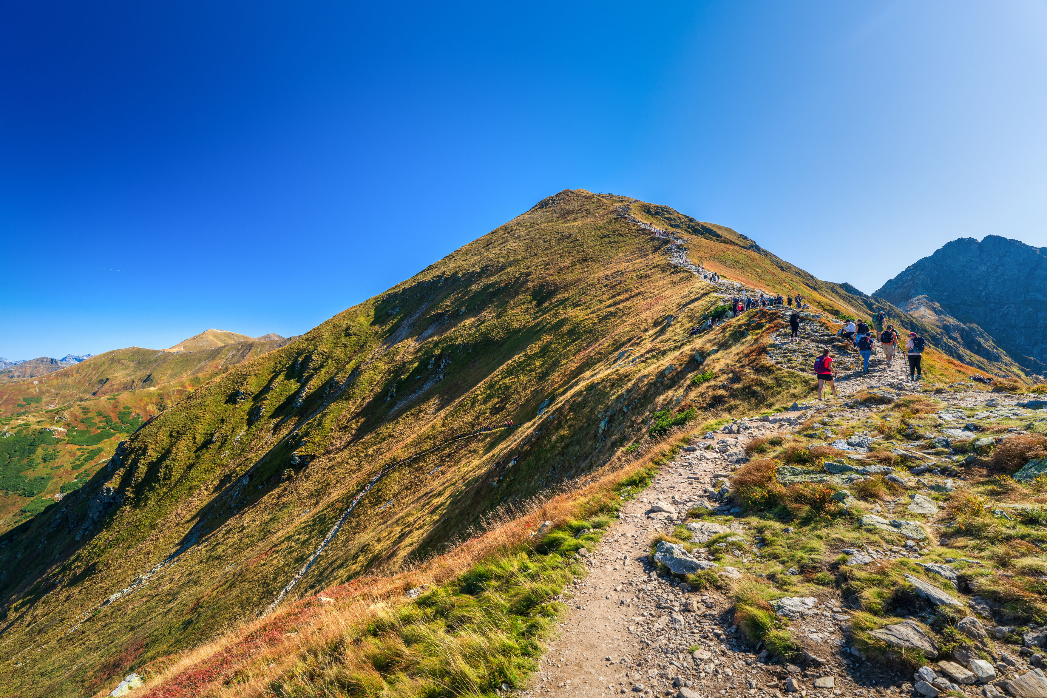
Roháčska hrebeňovka patrí medzi najatraktívnejšie, ale zároveň najnáročnejšie vysokohorské túry v Západných Tatrách. Z Roháčskej doliny trasa stúpa cez Sedlo Zábrať na Rákoň a Volovec, odkiaľ pokračuje po hlavnom hrebeni cez charakteristický Ostrý Roháč až na Plačlivé. Práve prechod Ostrého Roháča je technicky najnáročnejšou časťou túry – vedie exponovaným skalnatým terénom a na viacerých miestach je zabezpečený reťazami. Z hrebeňa sa otvárajú výhľady na Roháčsku a Smutnú dolinu, Roháčske plesá i okolité vrcholy Západných Tatier. Z Plačlivého trasa zostupuje do Smutného sedla a Smutnou dolinou späť k Ťatliakovej chate a do Roháčskej doliny. Túra je určená skúseným turistom s veľmi dobrou fyzickou kondíciou a bez strachu z exponovaného terénu. Aktuálny návštevný poriadok TANAP-u povoľuje pohyb iba po vyznačených turistických chodníkoch.
Pod Spálenou → Šindľovec → Adamcuľa → Ťatliakova chata → Sedlo Zábrať → Rákoň → Volovec → Ostrý Roháč → Plačlivé → Smutné sedlo → Smutná dolina → Ťatliakova chata → Adamcuľa → Pod Spálenou
Turistika
Parametre trasy
Veľmi náročná
Dĺžka
21,5 km
Časový odhad
10 min
Nadmorská výška
2 125 m
- Typ trasy Okružná
Turistická značka
Zelená
Červená
Modrá
Začiatok
parkovisko Roháče - Spálená
Koniec
parkovisko Roháče - Spálená
Mapa trasy
Povrch
Asfalt
Lesná cesta
Štrk
Vybavenie a služby na trase
Platené parkovisko
Odpočívadlo
Občerstvenie
Turistika
Parametre trasy
Veľmi náročná
Dĺžka
21,5 km
Časový odhad
10 min
Nadmorská výška
2 125 m
- Typ trasy Okružná
Turistická značka
Zelená
Červená
Modrá
Odkazy
Zaujal vás tento zážitok?
Stiahnite si aplikáciu Visit Orava a vyhľadajte ďalšie zážitky na Orave.